This blog takes place over two days so this is part one of two - we fell in love with the mountains near Craig-y-nos so much we had to go back a week later...
Part One - Friday 7th March
Weather: Sunny
It was still our holidays and we woke up to a glorious sunny day, we both wanted to head up to the Brecon Beacons so off we went to Craig-y-nos Country Park.
On the way (on the
A4067) you start getting glimpses of Cribarth - better known as the 'Sleeping Giant' due to the shape of the mountains resembling a man laying down - the trig point of Cribarth is situated right on his face. Little did we know in a few hours time we would be walking all over him!
 |
| The 'Sleeping Giant' - If you zoom into his face you can see the 'Cribarth' trig point |
Craig-y-nos country park isn't far from here, just past Abercrave and Pen Y Cae (roughly a 40 minute drive from Swansea). We arrived around 11am and there was plenty of parking spaces - it costs £2.50 to park all day. There's a small visitor centre, a cafe, toilets and the park is open 24hrs a day.
 |
| The cafe looks lovely - will have to try it one day |
I've been to the park a few times before and it is beautiful with so much to see: trees, rivers, ponds and meadows to walk in: an ideal place for a picnic, do some walking or bird watching. I don't want to talk too much about the Country Park in this blog, it deserves a blog all of it's own in the near future :)
There
are a few information plaques in the park and we noticed there was one
with a map of the park and surrounding areas. We saw that Cribarth was nearby and that it had a trig point and, as we can't resist a trig point, we
decided to leave the park and make our way up into the mountains.
Before
this we did have a quick stroll around the pond and saw an array of
different birds: swans, moorhen, mallard in the water, whilst
chaffinches, sparrows, robins and blue tits flew in and out of the
bushes - even a red kite graced us with it's presence in the sky above.
 |
| The large pond with lots of bird life - including a swan, mallard and moorhen |
 |
| A female mallard perched onto of a fallen down tree |
After our warm up around the pond we made our way out of the park and saw a sign across the road - it read 'access to hill via quarry' pointing left and 'access to hill via Danyrogof path' pointing right - we decided to go right. There isn't much path here so you had to walk on the grass verges of the A4067. Our original plan was to cut through Nantygwared Farm but there was a sign on the gate which read 'lambing season - find an alternative route at this sensitive time' - so off we went, making our way towards Dan-yr-Ogof. Just before you get to the main entrance we passed the River Llynfell - I believe that the head of this river comes from one of the caves in Dan-yr-Ogof.
 |
| Sign post...which way to go? |
 |
| There isn't much pathway on this stretch of the A4067 |
 |
| The river Llynfell |
Not long after passing this river we saw another sign that was pointing up to the mountains - we decided to turn here. Lucky we did as we were greeted with 4 or 5 Peacock butterflies. One happily posed for us on a rock for a great photo opportunity and we continued up the path until we got to a gate. Through the gate we realised that we were at the entrance of Dan-Yr-Ogof (which was closed).
 |
| The path up...if you look in the background your can see some of the rocks in the grounds of Dan-yr-Ogof |
 |
| The beautiful Peacock butterfly - Our first butterfly sighting of 2014! |
After a quick look at the dinosaurs and stones that grace the entrance we made our way back down the road and passed the stone circles, standing stones and ancient burial chambers that you can look at. There's a lot of info about them and even a narrative explanation from a dummy in a cave explaining what the stones are. They also have a Shire Horse Centre and a farm with Shetland ponies and emus - I definitely want to check out Dan-Yr-Ogof showcaves in the future, especially now I know there's a camping site there too. They are open from April 1st and here's a
link to their website.
 |
| The mystical stone circle in Dan-Yr-Ogof |
|
 |
| One of the emus enjoying the sunshine |
We
looked back and there was a fantastic view of Cribarth - wow, it seemed
such a long way away now and perhaps doing the Dan-Yr-Ogof route was
the the wrong way to get up into the hills. There was a yellow sign pointing up which read 'To mountain path way' and a well worn path to follow so off we went.
 |
| The view up to Cribarth |
 |
| This is the start of the walk, the sign reads 'to mountain...' |
The path leads upwards and is a reasonably easy with a gradual climb. The higher you climb the more impressive the scenes are and Craig-y-nos castle started looking smaller and smaller. We continued to follow the path...
 |
| Fantastic views of Fan-Gihirych to our left and... | |
| Climbing over a stile towards Cribarth,,, |
 |
| ...But a detour to Pwll-yr-Wydden first. |
We passed lots of rock piles (possibly burial cairns?) and once again more significant sized shake holes. We noticed not far from where we were was a row of big stones, we investigated and were greeted by 'Saith Maen - these Bronze age stones are quite unique to the Bre
con Bea
cons National Park as it's the Beacon's only row of stones. Saith Maen means seven stones, although sa
dly, two have now fallen.
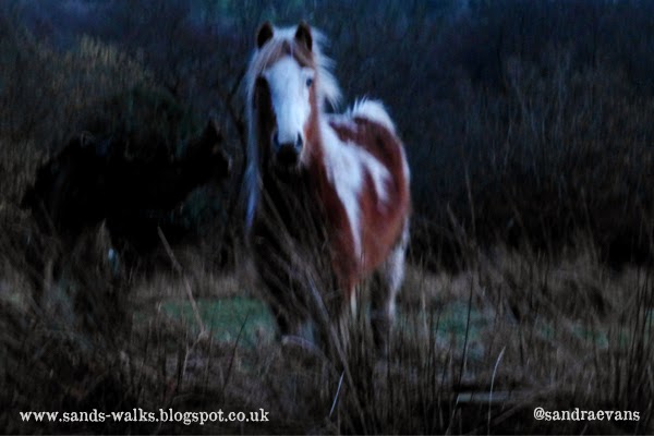
So with no other option we had to walk along the road until we got to Craig-y-nos. It seemed like forever and, without a proper path, very dangerous. Luckily it was now after 7pm and the traffic wasn't that bad. Eventually we reached a brown tourist sign saying Craig-y-nos was 1/4 mile away...hooray the end was near!
 |
| I could just about manage a smile lol :) |
 |
| Craig-y-nos castle at night |
We did make it back to the car safely and very tired - but we learned some valuable lessons on this walk: we definitely need to buy reflective gear, start a walk earlier & read the map a bit better :)
Having said that the walk was fantastic and, with a Wellington bomber crash site somewhere on these mountains, we knew we had to get back up there ASAP!
Part 2 coming very soon :)


Fab reading and we will b following ur tracks thanks
ReplyDelete